We harness the power of Geographic Information Systems to deliver advanced spatial data analysis and visualization tools. Our expertise spans across various sectors, from defense and agriculture to resource management and land digitization, empowering businesses with data-driven insights for informed decision-making.
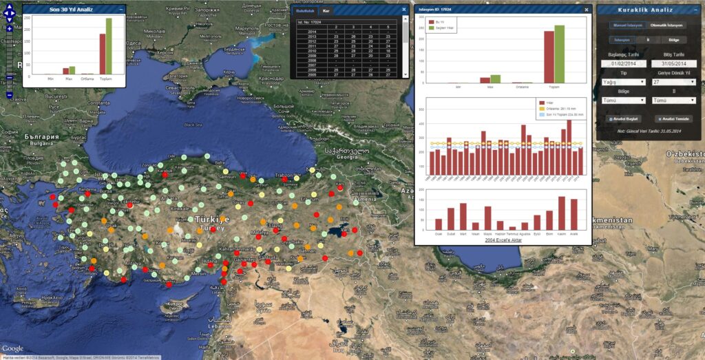
Drought Analysis
In this project, we conducted a comprehensive drought analysis using meteorological data such as precipitation and temperature from approximately 2,000 sensors located throughout various regions of Turkey. The data spans from the past to the present, allowing us to detect and assess drought patterns over time. The visual representation of this analysis includes charts and maps that illustrate key drought indicators, trends, and their geographical impact.
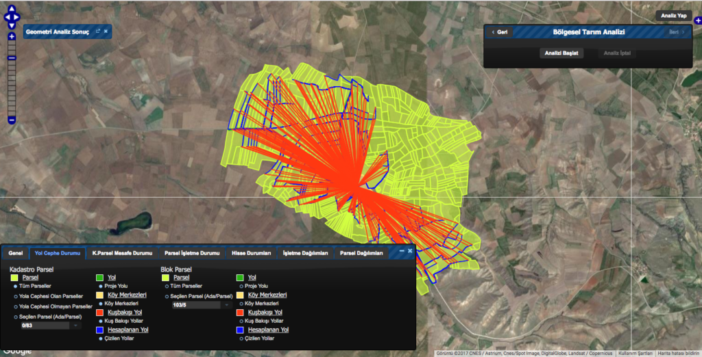
Consolidation Analysis
The software performs a comprehensive analysis of costs before and after land consolidation, enabling a clear comparison and detailed reporting of financial impacts. Geographic Information System (GIS) data is thoroughly checked for geographic and topological errors before being imported into the system, ensuring accuracy and reliability in the consolidation process.
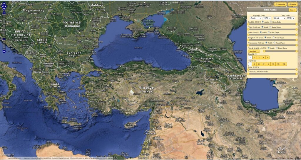
Plant Analysis
Our software provides a powerful tool for analyzing the optimal areas for agricultural production. It processes user-defined or database-driven data on climate, topography, soil type, and soil depth to determine the best conditions for growing various crops. By analyzing this data, the software identifies regions with the most suitable environments for specific agricultural products.
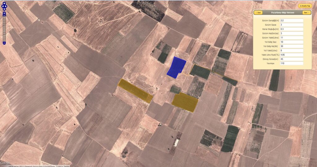
Marketting Information System
The application is designed to help farmers calculate the cost of their products down to the smallest details, including expenses such as road distance, fuel consumption, and row spacing. By integrating this system, farmers can obtain a precise and transparent overview of their production costs, enabling more efficient financial planning and better decision-making for their agricultural businesses.